|
Soils strongly control water chemistry. Likewise, water chemically weathers soils. Our lab group is investigating the how soil geochemistry is shaped by topographic, vegetative, and hydrologic controls. In particular, accurate measurements of soil air CO2 concentrations (pCO2) are important for understanding carbonic acid reaction pathways for continental weathering, the global carbon cycle, and climate change. Dr. Hasenmueller's group has measured the depth distribution of soil pCO2 along variable topography where controls on soil pCO2 (e.g. soil depth, moisture, and temperature) vary from ridge tops down to the valley floor, among planar slopes and slopes with convergent flow (swales), and between north and south facing aspects. The group has also
Current studies include: 1. Understanding topographic controls on CO2 concentrations in soils. 2. Determining the weathering potential of pCO2 in forest ecosystems. 3. Characterizing the activity of deep roots in bedrock fractures and their role in regolith weathering. 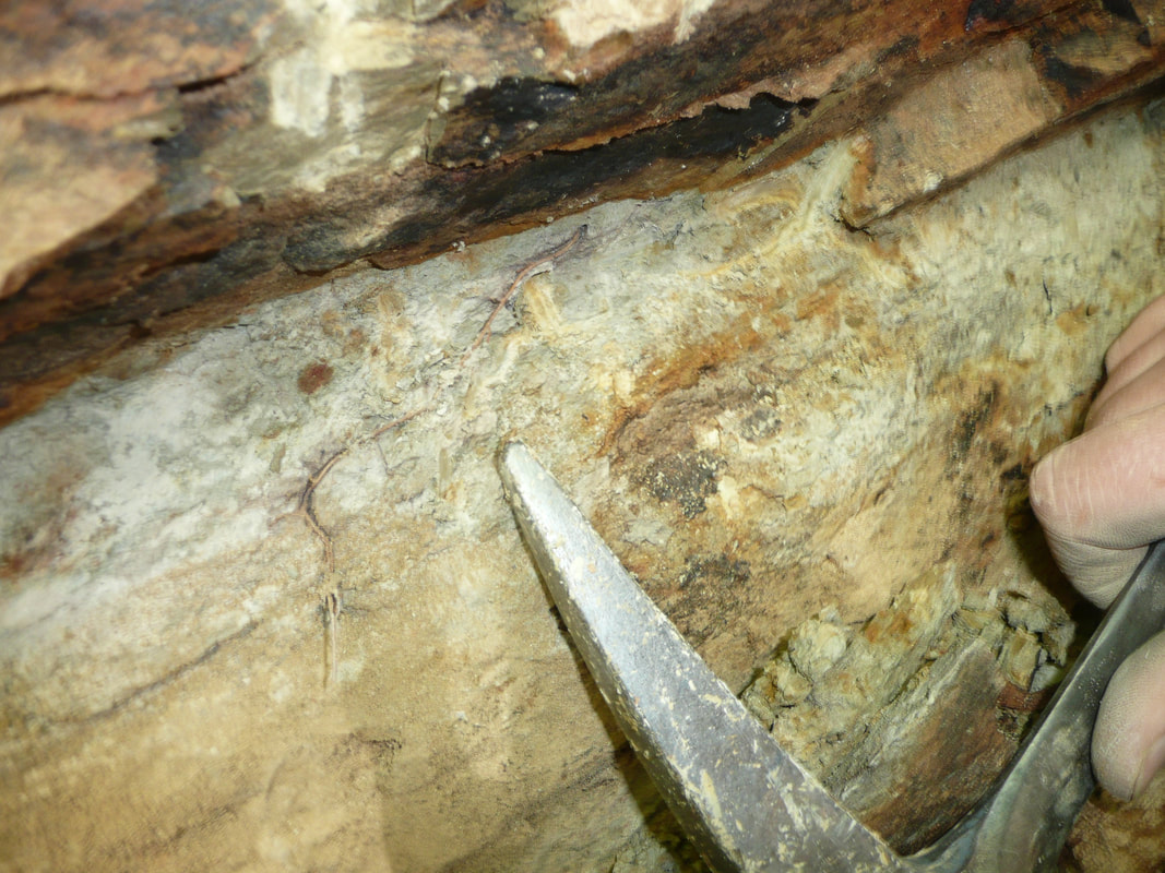
A fine root growing in fill material found in a rock fracture. Our research shows this fracture material was formed in situ weathering processes, rather than being transported from the overlying soil.
|
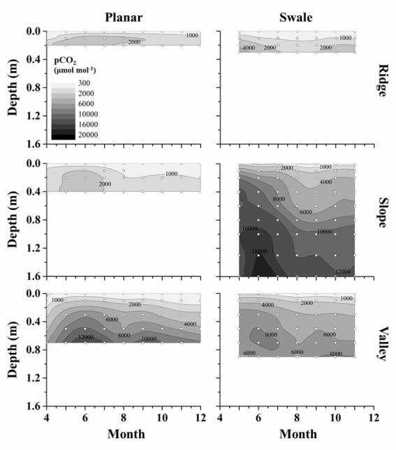
Monthly average soil pCO2 (μmol/mol) contour plots as a function of soil depth (m) and time (month) for ridge tops, mid-slopes, and valley floors in the planar slope and swale depression at the Shale Hills Critical Zone Observatory. Darker colors represent higher CO2 concentrations. Geomorphologically comparable locations like the ridge tops and valley floors have similar pCO2 profiles. However, the mid-slopes differ by up to 6x for the same depth because of differences in total profile depth, soil moisture, and diffusivity.
|
