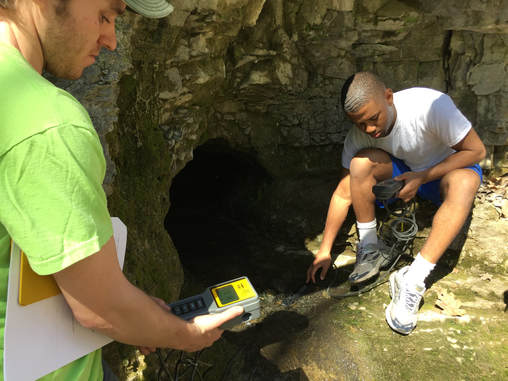
Students measure water quality parameters for a small karst spring.
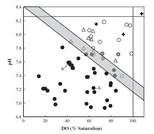
A plot of pH versus DO (% saturation) for phreatic springs (closed circles), cave springs (open circles), resurgences (gray circles), surface streams (open triangles), and treated wastewater (crosses) show "cave" springs and "phreatic" springs are easily identified by their geochemistry (from Hasenmueller and Criss, 2013).
|
Karst topography is a unique type of terrain formed from the dissolution of soluble rock. These landscapes include caves, sinkholes, and extensive groundwater spring systems and allow for rapid exchange of water and chemicals between surface waters and groundwaters. Discovery and exploration of underground passages (caves) are important for ecosystem conservation, to delineate their potential as collapse hazards, and to identify subsurface avenues for the transport of shallow groundwater and its pollutants. The Hydrology and Geochemistry lab uses geochemistry to identify the locations of caves in spring systems and to understand pollutant transport in these systems.
Current studies include: 1. Quantifying surface water and soil water contributions to karst systems. 2. Determining the concentrations, residence times, and accumulation of sodium and chloride from road salt in karst springs. 3. Developing a novel geochemical technique to determine whether groundwater flows through open cave passages or not (i.e., "phreatic" springs). 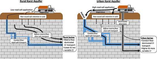
Schematic diagram showing the complex pathways of road salt contamination through karst aquifers (from Robinson and Hasenmueller, 2017).
|
